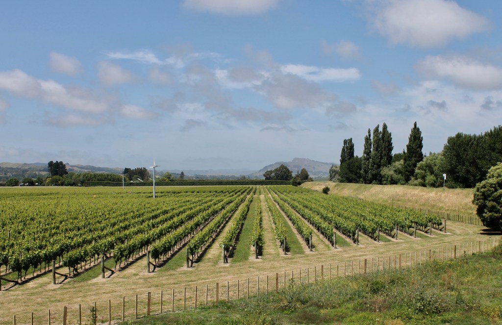
When we were planning this adventure, we told the travel agent we had no interest in wine tours. Other than being halfway to Rotorua, when we arrived in Napier in the Hawke’s Bay wine region, we were not sure why the travel agent sent us here because the only activity being promoted at the hotel was wine tours. Hawke’s Bay is NZ’s oldest wine region, the first vines having been being planted in 1851. It is still the second largest wine region in NZ. But I am complaining before I get us to Napier.
We left the birds of Zealandia reluctantly and headed up the west coast of the north island on Highway 1. The north island is not as dramatic as the south (since it does not have the alps of the southern island in the back of the picture), but the coastline would rival the Great Ocean Road in Australia.

Hawke’s Bay is on the east side of the north island, so after an hour or so, we turned off the ocean road of Highway 1 onto Highway 57 to take us over the high middle of the north island to the Pacific Ocean. Mostly sheep feed on these pastures.

By hour three of the journey, we were in wine country.
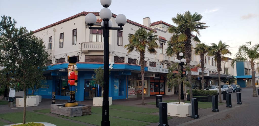
It turns out that Napier, founded in 1855, was an ideal place for a port for the growing region. But in 1931, its brick buildings were completely destroyed by an earthquake (one newpaper wrote that “Napier as a town has been wiped off the map”). The earth movement was so severe that old land surveys were meaningless (and had been destroyed in the fire that followed the earthquake). So with a clean canvass, they widened the streets and rebuilt the CBD in an art deco style. Napier is now known as the Art Deco Capital of the World. And we figured this out when we tried to find a place for dinner.

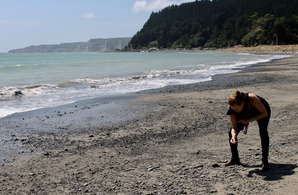
It also has a nice long black stone beach.

We also determined that there was a nesting ground for gannets (a relative of one of our favorite birds, the booby) at the southeastern point of Hawke’s Bay, a place called Cape Kidnappers. The Cape is a sandstone headland that was the site of an attempt by the Maori to kidnap a Tahitian interpreter from Captain Cook’s ship. The Tahitian escaped his captors and several Maori were killed by Cook’s men trying to aid the escape. So Cook named the Cape after the dead kidnappers.
But after the 30 minute drive to the Cape, we discovered that the trail to the Cape had been closed. A landslide six months ago washed out part of the trail along the cliffs and the Park Rangers were trying to figure out if there was a safe way to reopen the trail. The only way to get to the gannet colony was to pay a tour group $80 each and take a 3 hour trip. I took some pictures instead (we saw plenty of boobies in the Galapagos), while Dawn looked at the rocks on the beach.
The next closest attraction was Te Mata Park about 20 minutes away. Europeans thought the rocks of Te Mata resembled a man lying down, so they named it the “sleeping giant” (sort of sounds like the grandfather mountain story). The Maori name is now used. The chief attraction of Te Mata Park was that you could drive all the way to the top of the peak (we were still tired from the steep hill in Nelson). But I was not prepared for just how this narrow crooked road would be as it snaked up the mountain slopes to a parking lot on the peak.
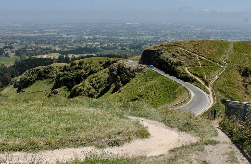
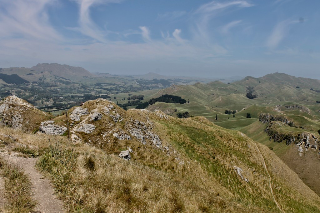
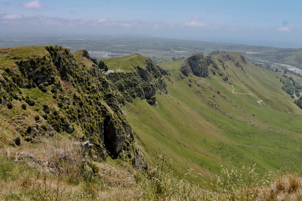
The views from the top were 360 degrees. There were even two platforms for hanggliders to launch over the cliffs. Dawn and I stayed behind the fence.

Luckily, when we started back down the road, there were no drivers trying to come up the road. My nerves were done for the day, so we headed back to the hotel for some beer and gin.
PS., Lena, since we elected not to take the 3 hour gannet tour, your inheritance was not spent today (except for an Italian seafood dinner). Mom got to spend time hunting rocks on the beach, so she is happy. I have had it with crooked roads, so I am the one going to bed.

Leave a comment